
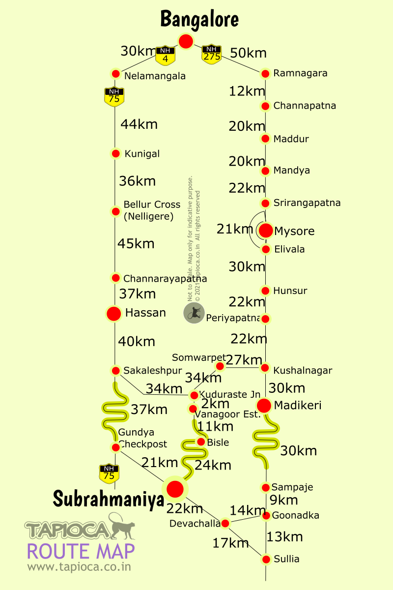
Bangalore to Kukke Subrahmanya Driving Directions
Bangalore to Kukke Subramanya distance is about 280km & 6 hours drive.
Subramanya
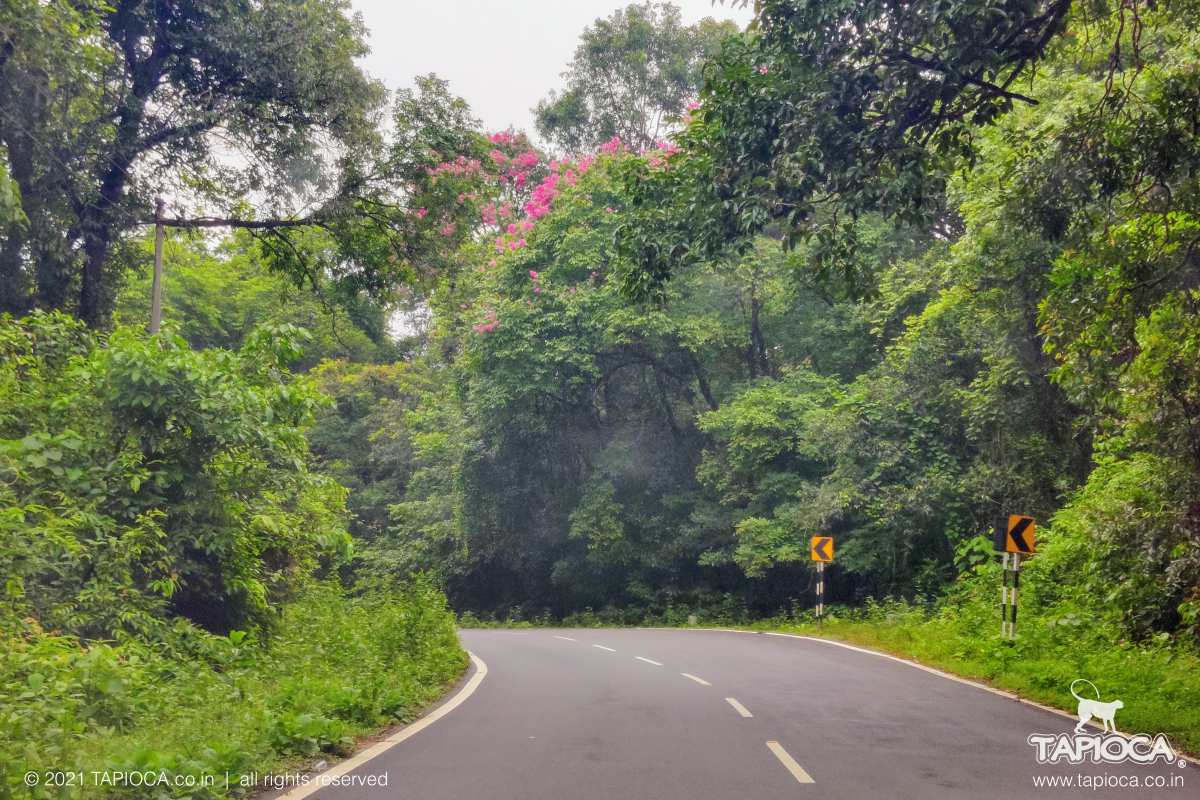
Gundya to Subramanya Road
L
et's divide the drive into four parts[#road]First 30 km is about getting out of Bangalore city at Nelamangala.
[#dot]Second 190 km is to reach the base of Ghat section at Sakleshpur.
[#dot]Third 37 km is negotiating the curvy roads & Shiradi Ghat section, till Gundiya
[#dot]The fourth and last 22km most scenic section of the drive is through the thick forest.
[#1] From Bangalore city take the NH48 (also called Tumkur road). Drive up to Nelamangala, where you've to take a left diveration into NH75. Yocan also take the NICE expressway to reach the NH48. The NICE Road exit is merged into NH48. After the NICE express toll booth, take the left diversion ( which says Tumkur, Pune, Mangalore etc.)
[#car]Now you're on the the NH48, at the NICE Road exit area, whichever route you took to reach here. There's a toll booth on NH48, immediately after the NICE expressway exit. From this toll booth, the diversion into NH75 is at 10th km. Keep the left most lane as to reach towards the diversion at Nelamangala junction. Thus you'll not miss the narrow exit into the service road, than connects to the NH75.
Once on this service road at Nelamangala junction, keep left for another ½km till you join the NH75. You're now out of the hectic city traffic!
[#2] The second part , almost 190 km is a pleasure to drive with great road condition. Baring a few stretches at manianannce, you'll be able to drive with more or less constant speed ( or on cruise, if your car has it). This is a toll route all through.
[#food]You can also find many food joints in this 190 km stretch. See the list here from Nelamangala to Sakleshpur.
[#3] Sakleshpur is the beginning the ghat terrain road. After the Hassan bypass, the road condition is so-so till Sakleshpur. Construction of 6 lane is in progress as of mid 2022.
The road beyond Sakleshpur is curvy. You've to trail slow moving trucks & tankers ahead of you, since overtaking is risky on the narrow bend sections. The route is through the forest section mostly, till you reach a junction called Gundya check post. Here's you'll leave NH75 and take final diversion into Subrahmanita.
[#4] The Gundya to Subramanya stretch is the most scenic and pleasurable of all the stretched described above. This is a silky smooth road, thad winds through the thickets of the western ghats forest. The road is more or less even with some natural undulations and many curves. You'll cross a rail underpass and Kumaradhara River and enter Subramanya town. From Gundiya, switch off the car ac and enjoy the refreshing pollution free air in this 22 km stretch!
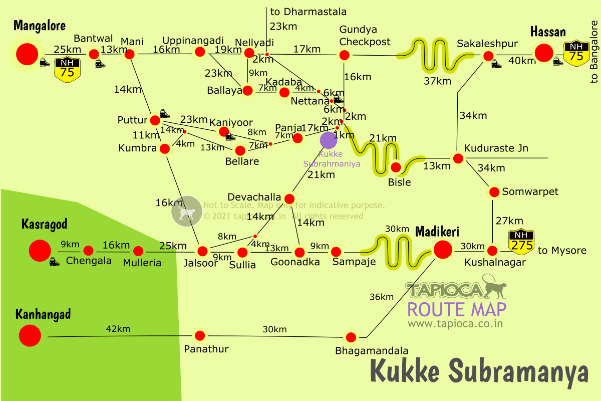
Kukke Subramanya
Bangalore to Kukke Subramanya road routes (via Mysore & Hassan)
Coorg
Distances to major places in and around Coorg
Kukke Subramanya
Bangalore to Kukke Subramanya
Bangalore to Kukke Subramanya road routes (via Mysore & Hassan)
Coorg
Coorg Routes & Distances
Distances to major places in and around Coorg